
We are undergoing maintenance, some features may not function as expect.
We regret any inconvenience caused.
Products based on Geographic
Global
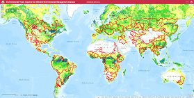
 Global Environmental Flow Information System
The interactive maps provide information related to Environmental Flows for the current condition and for the different Environmental Management Class...
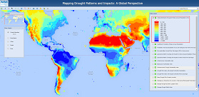 Global Drought Patterns
Drought can be generally defined as a temporary meteorological event, which stems from a deficiency of precipitation over an extended period of time c...
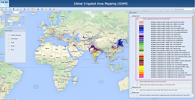 Global Irrigated Area Mapping
Knowing where the irrigated areas are is of important implications in decision making processes for food security, poverty alleviation, water resource...
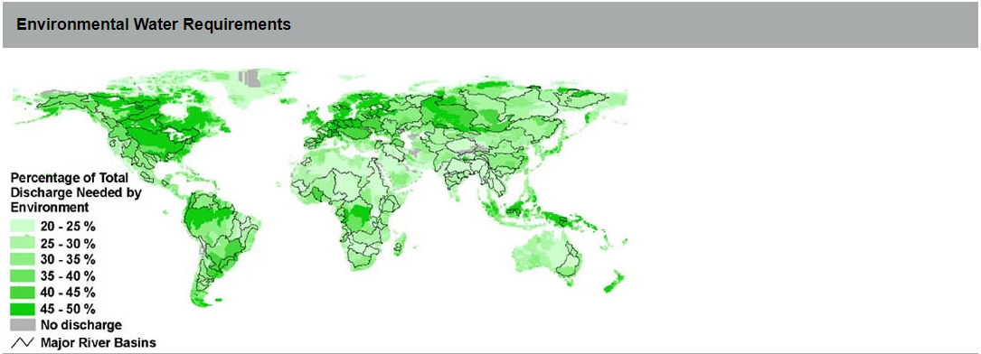
 Flow Management Classes
The maps presented here represent percentage of Mean Annual River Flow (MAR) required for different Environmental Management Classes (EMCs). EMCs are...
Regional
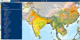 Irrigated Area Map - Asia & Africa
This page presents the initial results of irrigated area mapping of Asia and Africa. Unlike the previous Global Irrigated Area Map of 2000 (GIAM 2000)...
 Glacier and Snow in Asia Basin
In many major Asian river basins, glaciers and seasonal snow play special role in regional water cycle as the principal meltwater resources. Climate C...
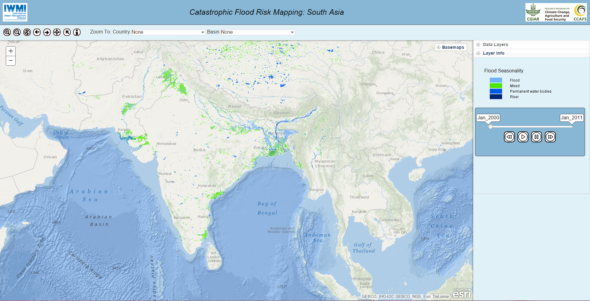 Flood Risk Mapping : South Asia
Floods are major natural disasters that affect many regions around the world year after year, causing loss of lives, damaging economies and human heal...
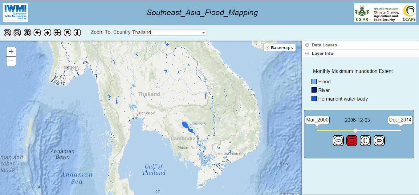 Flood Risk Mapping : South East Asia
Floods are major natural disasters that affect many regions around the world year after year, causing loss of lives, damaging economies and ...
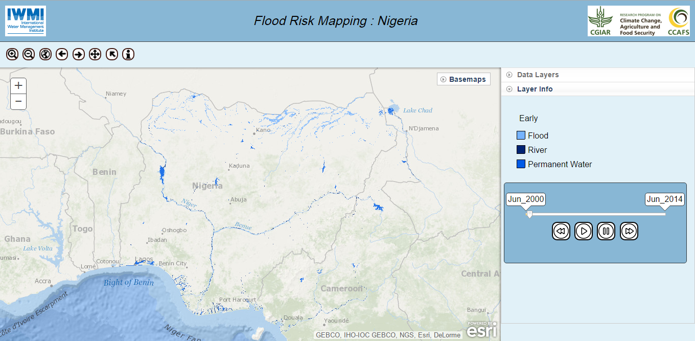 Flood Risk Mapping : Nigeria
Floods are major natural disasters that affect many regions around the world year after year, causing loss of lives, damaging economies and ...
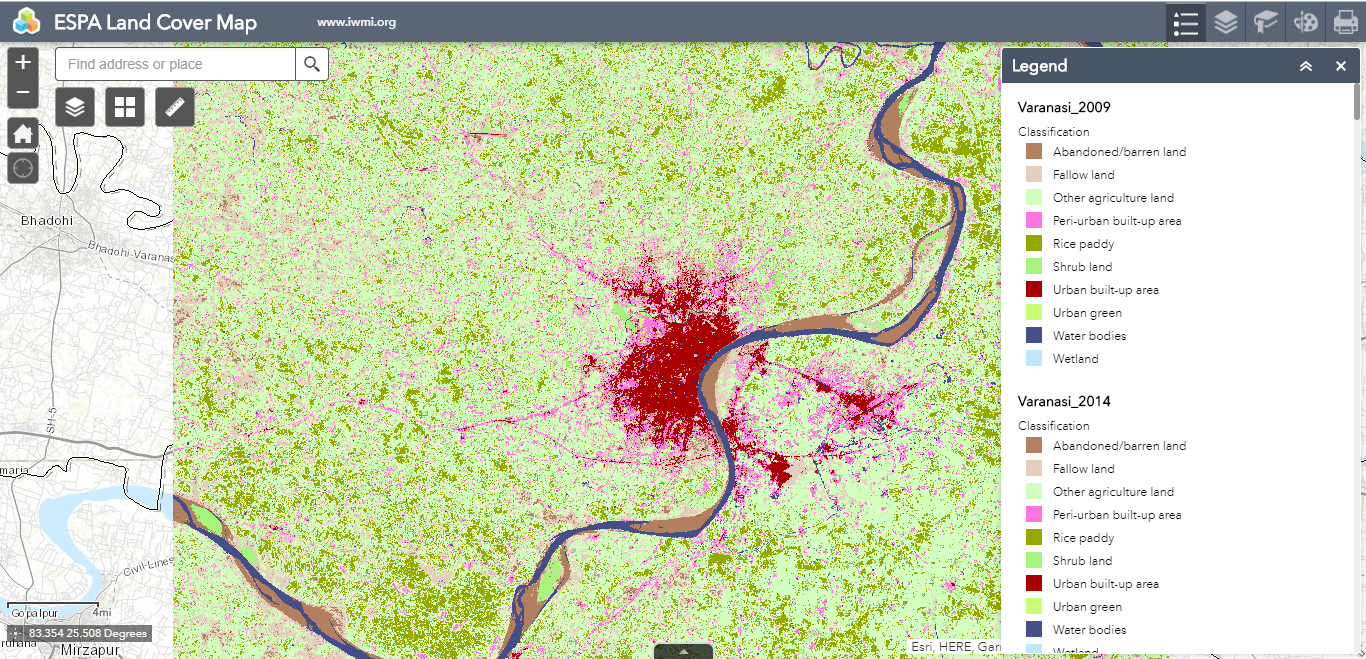 ESPA Land Cover Map
This ESPA-funded project looks at the inter-relationship between ecosystem services (ES), livelihoods and poverty in selected peri-urban areas of Sout...
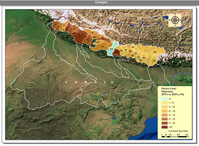
 Water Resources Mapping in Eastern Ganges Basin
This study, titled, “Assessment of Water Resources and Demand for Irrigation in Nine Districts within the Eastern Gangetic Plains”, was launched as a ...
Local/National
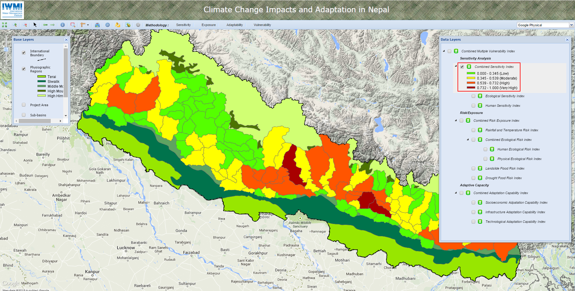 Nepal Climate Change Vulnerability
The Himalayan region is considered to be very sensitive to climate change due to the high variation in altitudes. Changes in cloud cover and rainf...
 Water Quality Mapping - Jaffna
The Jaffna Peninsula, falls within the dry zone in Sri Lanka, is underlain by Miocene limestone that is considered to have appropriate aquifer propert...
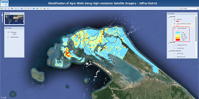 Agro-Well Mapping - Jaffna
Groundwater is the main source of water in the Jaffna District. Most of the agriculture in the district is dependent on groundwater sources. Crops and...
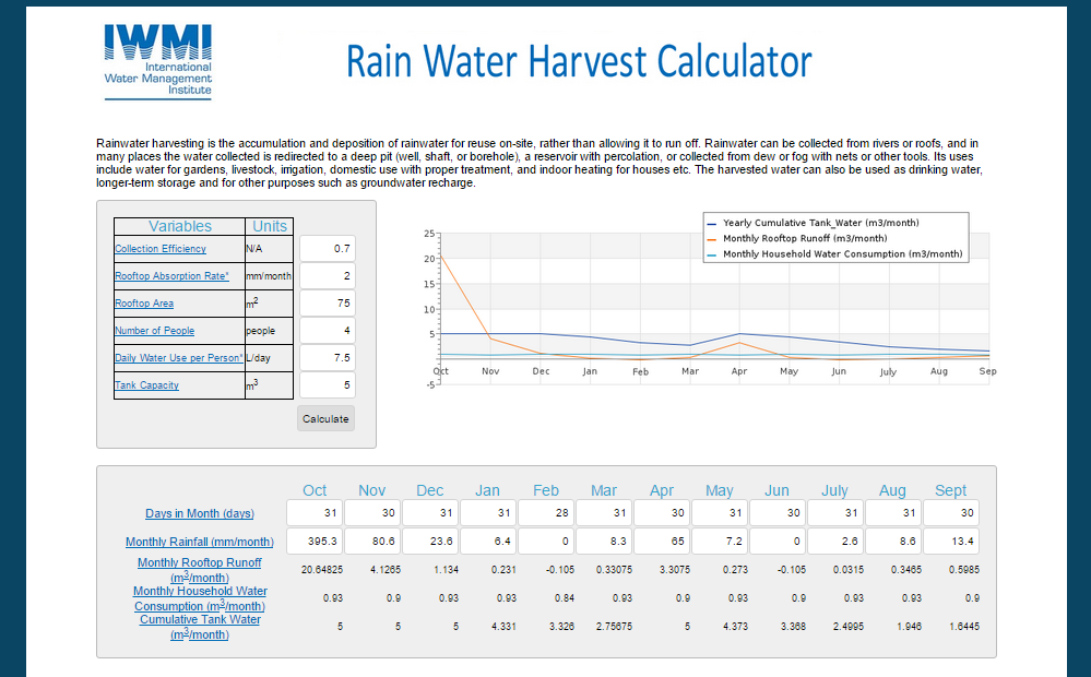 Rain Water Harvest Calculator
Rainwater harvesting is the accumulation and deposition of rainwater for reuse on-site, rather than allowing it to run off. Rainwater can be collected...
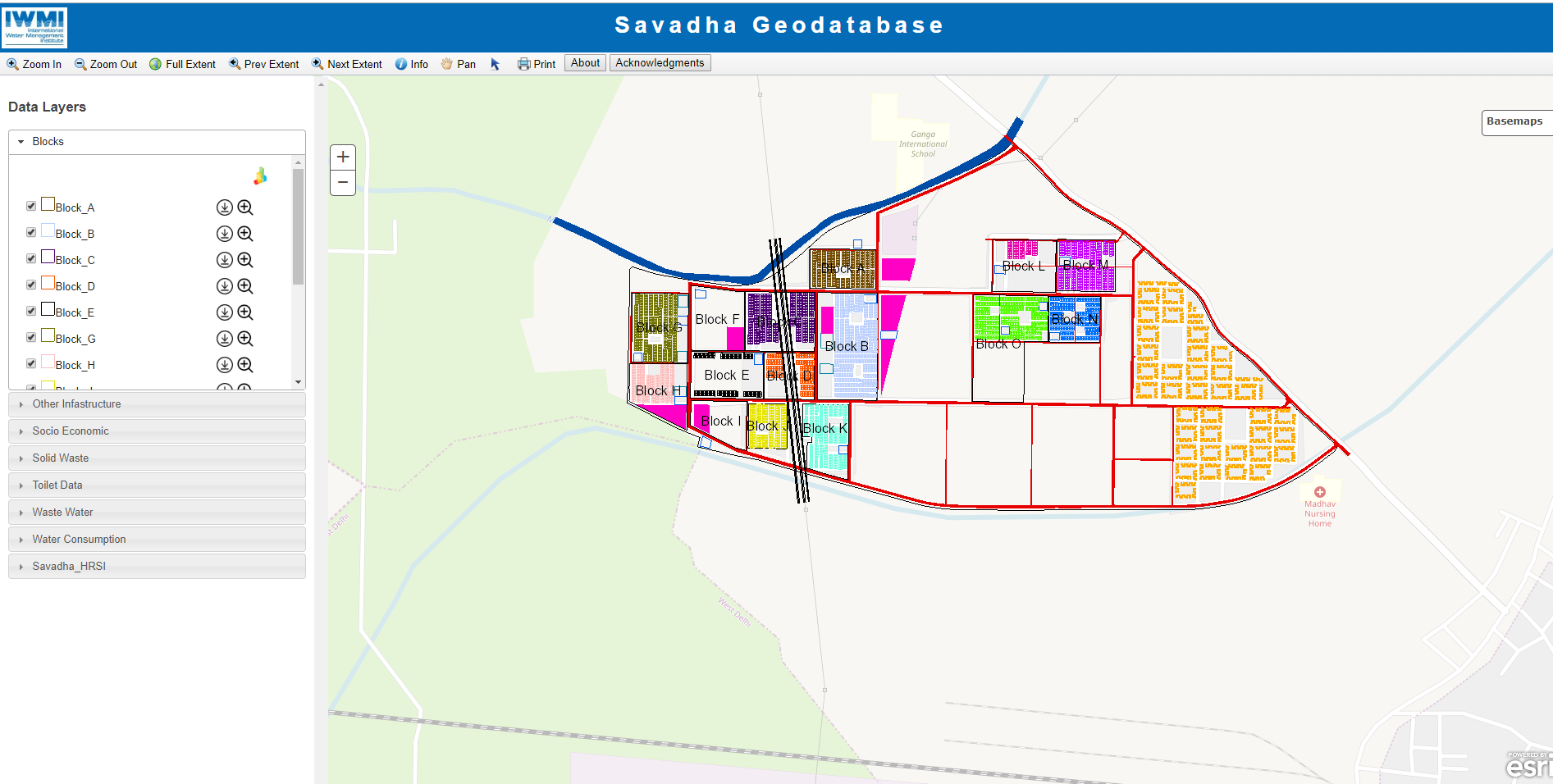 Savadha - Quality Sanitation for Urban Poor - Delhi
Many areas in Delhi are not covered by current centralized sewerage systems and are served through onsite-sanitation systems suc...
 Tana River Basin Information System
The Tana River Basin geodatabase has been designed based on a thematic structure that integrates geographic information from different s...
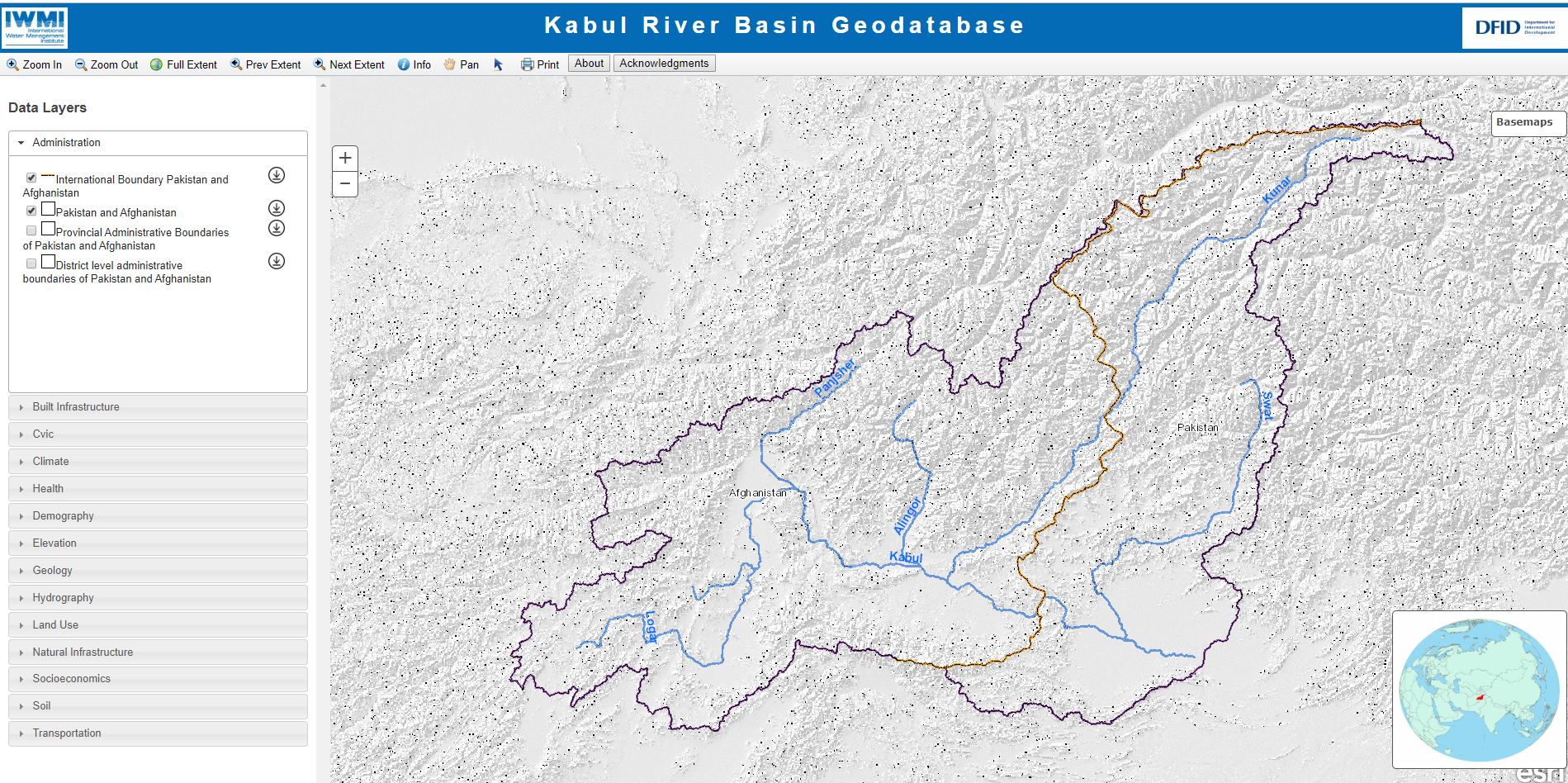 Kabul River Basin Geodatabase
Kabul River Basin Geodatabase has been designed based on a thematic structure that integrates geographic information from various sources. ...
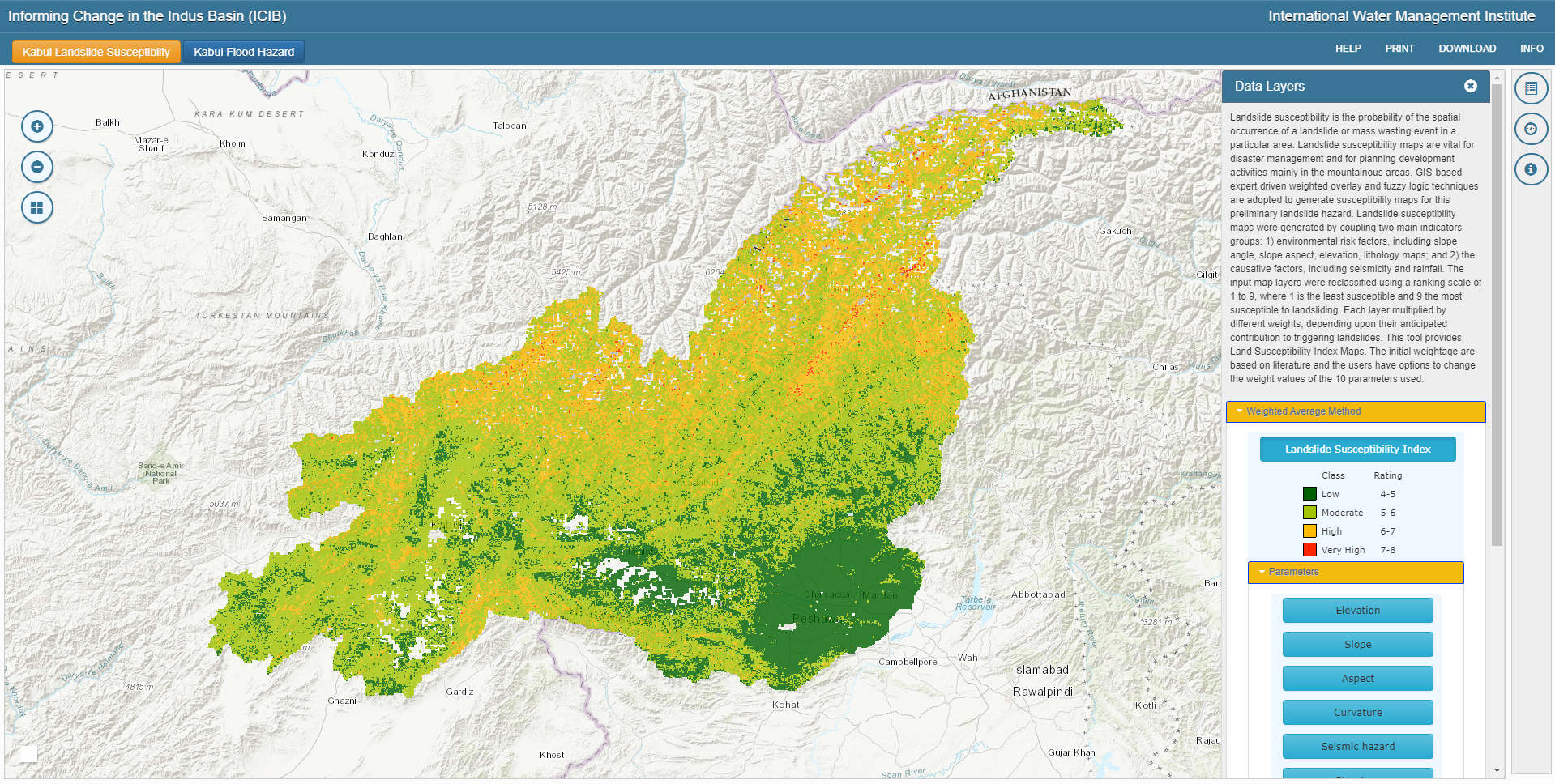 Kabul River Basin Decision Support Tool
Landslide susceptibility is the probability of the spatial occurrence of a landslide or mass wasting event in a particular area. Landslid...
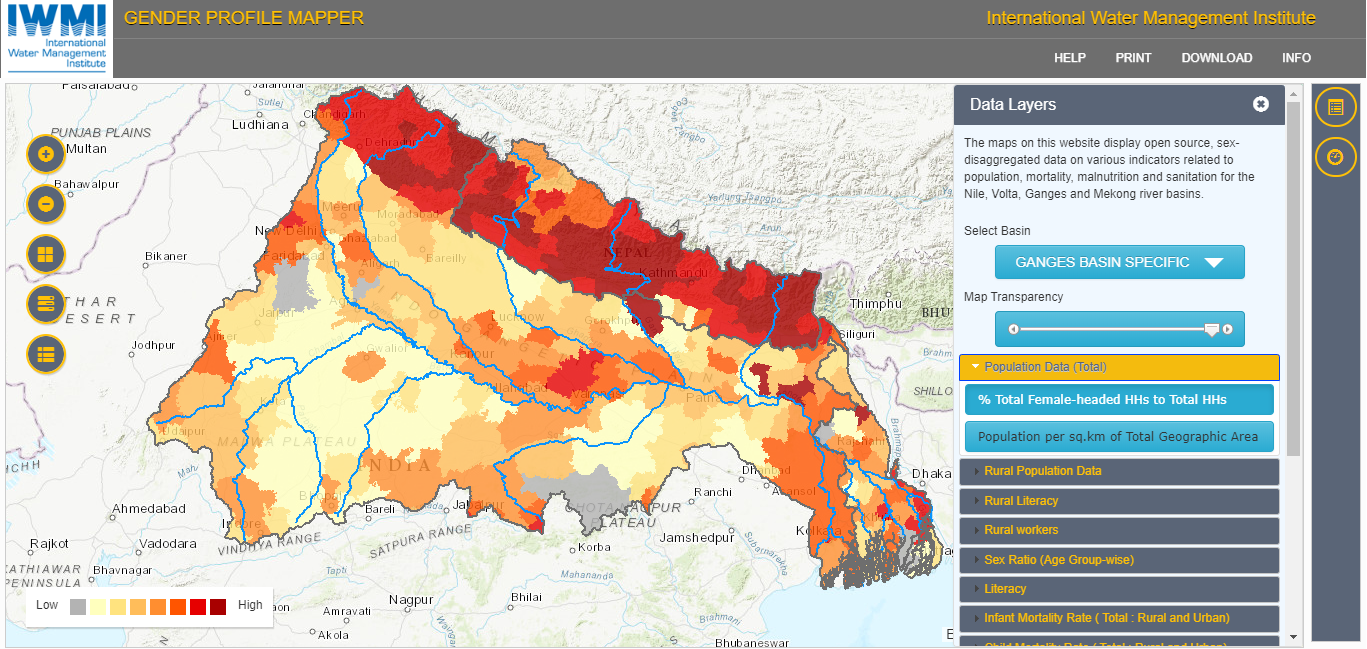 Gender Profile Mapper
The maps on this website display open source, sex-disaggregated data on various indicators related to population, mortality, malnutrition...
Geographic
- Global(4)
- Regional(7)
- Local/National(9)
Thematic
- Agriculture(4)
- Water(3)
- Drought & Flood(5)
- Environment(3)
- Gender(1)
Share this on


International Water Management Institute
Headquarters : 127,Sunil Mawatha, Pelawatte, Battaramulla, Sri lanka. Telephone +94-11 2880000 | Fax: +94-11 2786854 |
Email: [email protected]
This page was last updated on Friday, April 25, 2014